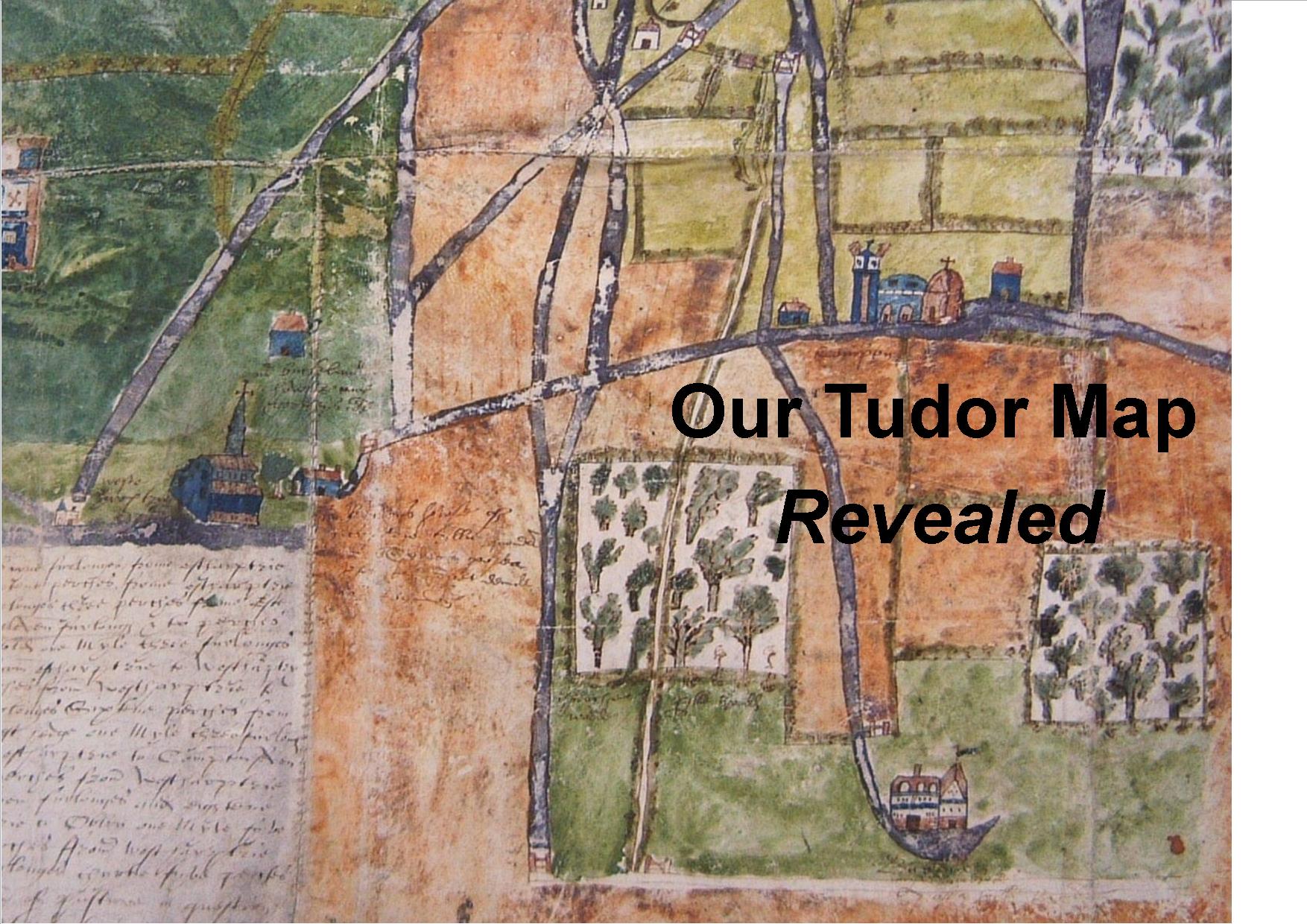
Extensive research has been undertaken by Society members into a map of our area dated circa 1570.
This is a very early example of pictorial map making as we are used to today and The Tudor Map is a very significant historical artefact.
We have produced a book about the Tudor Map which is available price £4 plus postage, on request via the website or telephone 01761 221275
Further research information concerning The Tudor Map is available by clicking the attachments below.
Name or Features on the Tudor Map
List of Tudor Map People and Places

Hello, I wondered if there are any copies of your book about the Tudor Map still available? My great-grandmother was a Roynon, born in Compton Martin in 1849, and I have been researching her family history. I would love to buy a copy of the book, so would really appreciate it if you could let me know. Many thanks.